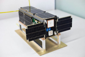
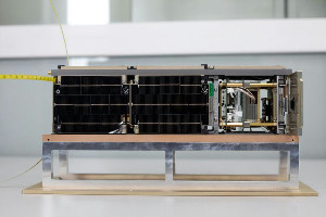
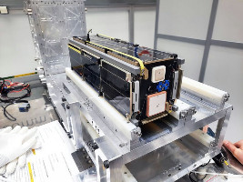
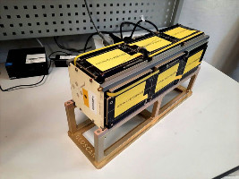
Horizon Spacecraft

Horizon
Horizon
Horizon
Horizon
Horizon
Horizon
Name Horizon (Horizons, RS59S, Space-PI, Space π)
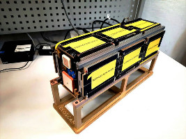
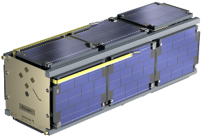
Form factor CubeSat
Units or mass 3U
Mass in kg 3.2 kg
Status Operational (Many packets with data or visible packets on SatNOGS, last checked 2024-12-19)
Launched 2024-11-04
NORAD ID 61757
Deployer 12U Deployer [Aerospace Capital]
Launcher Sojuz
Organisation Baltic State Technical University “VOENMEH”
Institution University
Entity type Academic / Education
Headquarters Russia
Manufacturer AIVT by Geoscan
Oneliner

Studying the effect of radiation on electronic components, testing an active orientation system based on flywheel engines, photographing the Earth's surface.

Description

Studying the effect of radiation on electronic components, testing an active orientation system based on flywheel engines, photographing the Earth's surface, studying the capabilities of radio links using linear frequency keying and image transmission using fountain codes, studying the degradation of the characteristics of solar panels of various compositions under the influence of cosmic factors space.

Payloads:

The satellite's payload includes:

  1. A solar panel module, designed to study the degradation of the characteristics of solar panels of various compositions under the influence of space factors;

  2. Electronic components research module. It features advanced magnetoresistive random access memory (MRAM) chips that are tested to withstand space radiation. 

  3. CubeSat mechanical orientation unit, implemented on the basis of electric motors. When controlling the flywheel system, the satellite is oriented along three axes;

  4. Payload control system. It consists of transceiver modules operating in the VHF and S bands, a computing unit with a camera with a resolution of 3840x2160 pixels. 

  5. Will employ a deployable solar panel.

  6. Electronic components testing unit.

  7. Flywheel satellite attitude control unit.

  8. S-band communications unit with Earth remote sensing functionality.
    Radio amateurs across the world will be able to receive images from onboard cameras and telemetry data. Images will be transmitted on UHF link using GEOSCAN framing. Images can be decoded using commonly available tools. Transmission of images will also take place on S and X bands. For S-band transmission LoRa modulation will be used. X-band downlink will be using DVB-S2. Decoders will be published online, per downlink activation. 

Sources [1] [2] [3] [4] [5]
Photo sources [1]
COTS subsystems
  • PLATFORM - Geoscan
Subsystems sources [1]
On the same launch

Last modified: 2024-12-28

Feel free to connect at any time.

Created by Erik Kulu

Email: erik.kulu@nanosats.eu
LinkedIn: linkedin.com/in/erikkulu

Social Platforms

LinkedIn: Nanosats
Twitter: @nanosatellites

Sister Websites

NewSpace Index: newspace.im
Factories in Space: factoriesinspace.com

Copyright © 2014 - 2025 Erik Kulu